
Project Summary
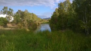
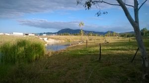
Louisa Creek, located in dry tropical Townsville, is a locally important freshwater environment which flows into regionally significant wetlands and coastal environments. It has been impacted over the years by urban/commercial runoff, habitat removal, and more recently watercourse relocation. However efforts have been made by the Council for over fifteen years to retain its ecological values, and improve aesthetics, community use and hydraulic capacity. These efforts continue today and will continue into the future through the implementation of the Louisa Creek Waterway Management Plan (2011).
Size/Type of Project
The Louisa Creek Waterway Management Project involves the management over 6km of water course to:
- Improve the quality of water
- Maintain and improve hydraulic capacity of the system
- Increase ecological values within the catchment including improved fish passage
- Prioritise management options that will have the maximum net benefit to the system
- Engage community through activation of community groups
- Encourage passive recreation and custodianship in key areas
- Establish and enhance terrestrial connectively for fauna passage
Site Context
Louisa Creek runs from Mount Louisa (a mixture of urban and green space landuse) to the floodplain of the Town Common Conservation Park – a wetland with regionally significant environmental values. Louisa Creek eventually discharges into the Bohle River which then meets the sea at Bushland Beach.
The region experiences a typical dry tropical climate, characterised by a hot, humid and wet summers (December to March) followed by a prolonged but cooler dry season with lower humidity levels (April to November).
Solodic soils are predominant, with some grey clay and alluvial deposits, and in general the heavy clay subsoils are very poorly drained, have poor physical structure and are low in fertility (McNamara, 1981). Saline duplex soils also appear in the lower catchment where the water table rises to about 600mm below the surface (McNamara 1981). Acid sulphate soils are also prevalent in the lower catchment.
The upper part of the catchment is predominately urban, and the mid-catchment has commercial/light industrial landuse.
Issues and Constraints
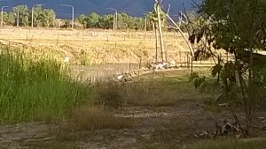
Over recent years commercial/light industrial development has increased adjacent to Louisa Creek. To provide adequate space for this development parts of Louisa Creek were relocated, while other sections were narrowed and constrained. This development also contributed large amounts of sediment and litter and ultimately changed the hydrology of the system. Roads, bridges, crossings and culverts added over the years have also impacted on the hydrology and created barrier to fish passage.
One of the main constraints to undertaking works in and around Louisa Creek is the presence of highly dispersive soils and, in some sections, the presences of acid sulphate soils. Also high salt concentrations and high ph levels in soils.
Key Practices
The following management measures have been implemented over a 15 year period and continue to be applied today:
Practices:
- Installation and retrofitting of several gross pollutant traps at key points to treat gross pollutants from surrounding commercial/light industrial areas
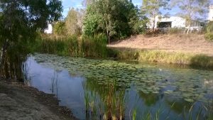
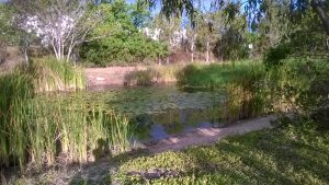
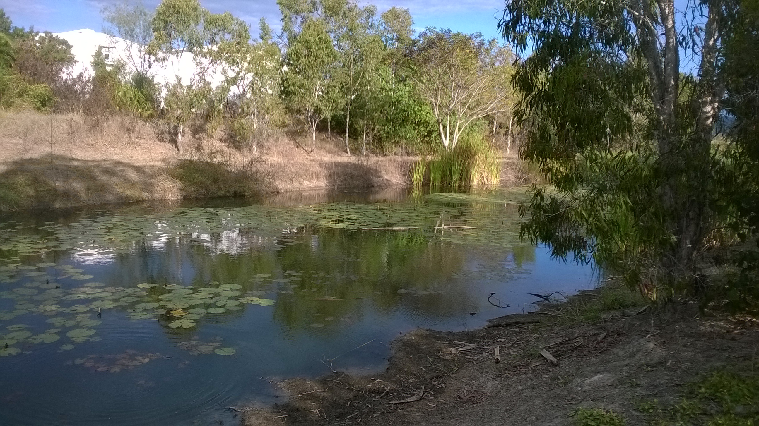
- Water course relocation was undertaken using natural channel design principals by including meanders, deep pools, riffles and revegetation. The design also incorporated maintenance and community access points.
- Development of project sites for youth and community activation programs such as Greencore, Job Futures, Conservation Volunteers Australia and the Green Army
- Involvement of the local community via Louisa Creek Watch. The volunteers undertake regular water quality monitoring, litter and weed removal activities and report results back to Council.
- Sediment and weed removal activities
- Revegetation with naturalised species that have high broadleaf densities to suppress weeds and to reduce maintenance
- Strategic machine access for weed and sediment removal
- Use of ESC during watercourse relocation activities involving extensive soil science/amelioration, use of probiotics and design outcomes outside of typical engineering scope to deal with the dispersive soils
Successes:
- Use of broadleaf species to reduce maintenance and strategic machine access points have been very successful
- Pools and riffle designs have demonstrated increased fish and macroalgal diversity and concentrations
- Design for appropriate depth of water can effectively suppress challenging aquatic weeds
- Effective erosion and sediment control can significantly improve functionality of natural channels and greatly reduce operational maintenance costs
- Activation of community groups can improve asset custodianship whilst also leverage funding to reduce ongoing maintenance
- Collaboration between eventual asset managers and planning officers during design stages can provide long term environmental and financial outcomes
Monitoring
The Louisa Creek Watch volunteers regularly monitor water quality including: temperature, DO, pH, and conductivity, and macroinvertebrates. The Council undertake regular inspections and maintenance activities.
Lessons learned
Relocating and modifying a natural system inevitably requires more ongoing intervention, maintenance and management than would be required for a natural system. Despite incremental modifications over the years and ongoing impacts from the surrounding landuse, Louisa Creek is still an important aquatic environment in the Townsville landscape. It is one of the few smaller order freshwater streams which runs for most of the year, and as such it still provides important habitat for birds, fish, and other aquatic flora and fauna. As it discharges into an important wetland (Town Common and Bohle River), improving its water quality is seen as a priority by the Council and the local community. Efforts from the Council to treat and remove pollutants and manage weeds have led to the creeks preservation so far; however the recent realignment, dredging, installation of culvert crossings and new commercial development could see it decline further. In response to this risk Council produced a plan in 2011 to guide the future management of Louisa Creek. This plan is being progressively implemented with the aim of managing this waterway for the protection of environment, community and infrastructure. Further information on this project can be obtained by contacting Townsville City Council: 1300 878 001