Project summary
Flat terrain and a sugar cane farming history are synonymous with the region around Mackay. Traditionally, on such flat terrain, drains across the region were designed solely for stormwater conveyance. Drains were concrete-lined, with turfed batters requiring maintenance for the life of the asset.
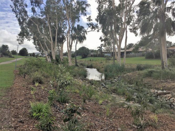
Mackay Regional Council identified Little McCreadys Creek in Rural View as a site suitable for developing and showcasing best practice methods for improving stormwater quality, rehabilitating waterways, enhancing aquatic habitat and improving ecological corridors. Council, with assistance from local natural resource management body Reef Catchments, used funds collected under Council’s Voluntary Mechanism for Stormwater Quality Management to restore a section of Little McCreadys Creek. This was done by installing rock and timber bed and bank controls, fishways, benched wetlands and dense riparian vegetation.
Project scale and objectives
A 720m stretch of Little McCreadys Creek between Bucasia-Mackay Rd and Dawson Blvd was rehabilitated. This stretch of waterway had in the past been heavily modified, including being straightened and formed into a trapezoidal channel. Sitting within a catchment with an existing catchment management plan, the project aimed to:
- improve water quality entering estuarine and Great Barrier Reef habitats,
- increase biodiversity, fish habitat and fish passage,
- provide a local example of a naturalised waterways, for comparison against traditional concrete and turf channels,
- improve visual amenity, and re-establish riparian vegetation and ecosystem service values.
Site context
Little McCready’s Creek flows east through Rural View before joining with other local waterways and entering the Great Barrier Lagoon. The surrounding catchment is progressively transitioning from rural to urban residential. In the past, it was used for cane farming. During this period, the creek was generally shallow, boggy and filled with sediment from land clearing and agriculture.
Issues and constraints
Consultation with the community revealed most people to support the project, however concerns were raised about the potential for the works to increase local flooding and mosquito populations. Council undertook hydraulic analysis to ensure that there was no increase in flooding on private property. Mosquitoes were found to be an issue in the existing drain. Fish passage was incorporated into the design to, amongst other benefits, allow fish to move into the rehabilitated waterway to prey on mosquito larvae.
Fish passages must be constructed to tight tolerances if they are to function as designed. If constructed incorrectly, they can themselves become a barrier to fish movement. It took several attempts to appropriately key the rocks in the fish passage into the bed and bank.
Construction and ongoing costs
Restoring this section of Little McCreadys Creek, including all community consultation. civil design, landscape design and construction cost $350,000. All plants were provided in-kind. At present, long term ongoing costs are unknown.
Monitoring
Visual inspections are undertaken as part of regular maintenance operations; however, there is no regular monitoring program.
Lessons learned
In tropical climates, weeds are an issue that must be managed. Plants were installed at a density of 5 to 6 plants per square meter, but even at this density, bare earth remained. Weeds took hold in these bare spaces, and maintenance became intensive. A thick layer of forest mulch was retrofitted to the site to fill the gaps and suppress weed growth. In areas at risk of erosion, the mulch was pinned down to prevent it being washed away. This strategy was successful in limiting weed growth to a manageable level.
Reference
Existing case study provided by Luke Galea at Mackay Regional Council.
Email conversation with Luke Galea.
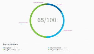
Living Waterways Score
See the score card or Little McCreadys Creek here


